Mapper Interactive World Map for Elementor
Antivirus scan
Powered by ClamAV
✅ Verified clean
This product file has passed our security filters.
Want to run a fresh ClamAV scan right now? Takes a few seconds and shows scanner version, signature DB and live result.
This can take 5 to 30 seconds.
Clean file Threat detected
No threats detected in this file.
- File
- Size
- Scanned
- ClamAV
- Signature database
⚡ Powered by ClamAV
Scan could not be completed
Report product
If you detected an issue (broken file, malware, inappropriate content, etc.) let us know and we'll review it ASAP.
Sign in to report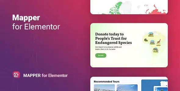
About Mapper Interactive World Map for Elementor
Built for showing where something is, not for street-level maps
Listing offices, stores or destinations on a page often ends up as a dull table or a static image nobody can explore. Mapper Interactive World Map for Elementor solves that case: a map by regions, colored and with information on hover or click.
It is a widget for Elementor, so it only makes sense if you build with that page builder. It also works with territories (world, continents, countries and their provinces or states), not with streets or exact addresses. If your client wants visitors to search for a street, plot routes or see a location down to the front door, you need a different type of map. Here every point is tied to a region.
How much detail fits in a map of regions
Here is what almost nobody considers before buying: a map by regions forces you to decide which message you want to get across, because not everything fits. A business present in ten countries is easy to explain, but one with forty stores in the same city is not, because they would all land in the same territory.
The available map levels are:
- The whole world.
- A continent (Africa, Europe, the Americas, Asia, Oceania) or a sub-continent, such as Western Europe or Central Asia.
- A specific country.
- A country with its provinces or states (the United States, Australia, Germany, Canada and others).
- The United States divided by metropolitan areas.
Choose the level based on where your information is concentrated, not on how striking it looks.
Three ways to flag an area with Mapper
The plugin offers three display modes, and it helps to know what each is for:
- Regions: paints a country, province or state in a chosen color. Useful for showing where you operate or which areas you cover.
- Markers: places a dot, an icon or an image on the region, with adjustable colors and sizes. Good for highlighting specific offices or attractions.
- Text: writes a label pointing to a region, for infographic-style maps.
To make the map informative, each region can show a tooltip (a pop-up box) triggered on hover or on click. On mobile, where there is no mouse, click is usually the more sensible option.
Coloring by values to compare regions
If you handle statistics (sales by country, number of customers, demand level), there is a mode with a legend where each region's color depends on its value. You choose a color scale and the map paints each area according to the data assigned to it; the legend helps to read the range. This is what turns the map into a small infographic rather than just decoration.
Keep in mind that you enter the data by hand in the widget: it does not connect to a spreadsheet or an external database that updates itself.
Style settings and starting points
You can change the map's height and width (with responsive controls), the background color, the tooltip color, the colors of active and inactive regions, markers and fonts, plus the size and border of each element. It includes five pre-styled templates as a starting point, and lets you create unlimited maps across the site. It comes with a translation file (.pot) and works with right-to-left writing, which is handy if your site is multilingual.
Frequently asked questions
Does it work without Elementor?
No. It is an add-on for Elementor and is used as a widget inside that editor.
Can I show the exact address of a store?
Not as a street map. You can mark the region where it is and put the address in the tooltip text.
Is it suitable for a real estate agency or a chain of stores?
Yes, if what you want to show is which countries, states or provinces you are present in. If you want to pinpoint each property precisely, it falls short.
Can I use more than one map on the same site?
Yes, the number of maps is unlimited, both on a single page and across the site.
Version history
-
v
1.0.0 Current 8 Jan 2025
Customer reviews
Sign in to leave a review. Only people who have the product can review it.
No reviews for this product yet.
Frequently asked questions
-
GPL (General Public License) is the license under which WordPress and most premium plugins/themes are distributed. It grants you the right to use, modify and redistribute the software in as many projects as you want, with no domain restrictions.
-
Yes. With membership you get automatic updates via our GPLClub Updater plugin (installed on your WP, detects new versions and applies them). With individual purchase, you get one year of manual updates from your account.
-
Depends on the plan. Monthly: 3 domains. Semi-annual: 7. Annual and Lifetime: 15. Individual purchase: 1 domain.
-
GPLClub offers its own support for installation, configuration and compatibility. For direct support from the original author (feature requests, product-specific bugs), a license purchased from the author is required.